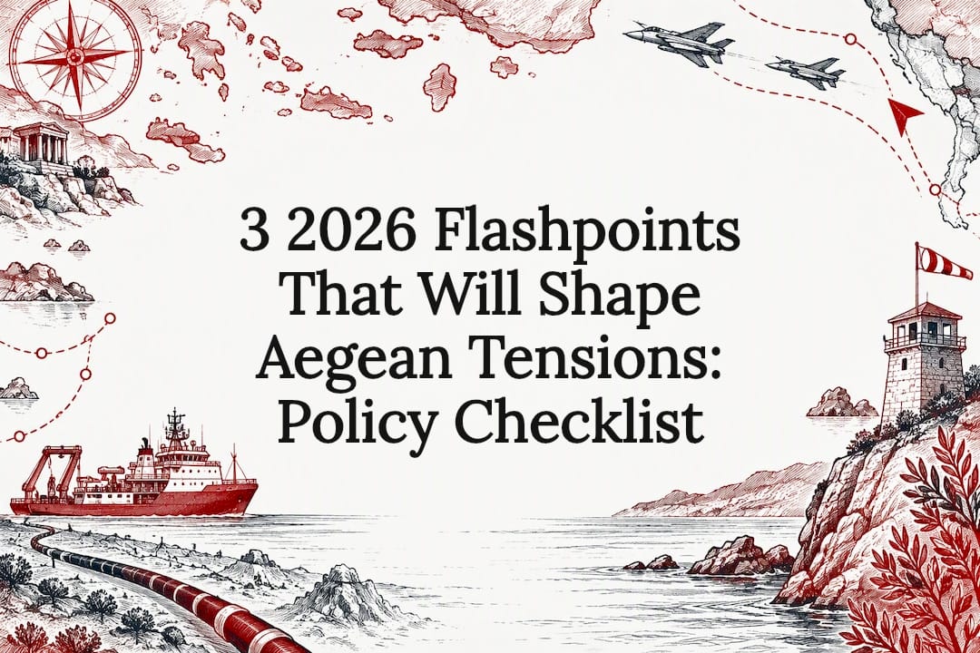
Current friction in the Aegean looks set to stay in low-to-moderate grey-zone territory rather than tip into open conflict, though the risk of a sharp spike rises whenever energy infrastructure work or research-vessel deployments overlap with contested waters. The clearest drivers right now are the Great Sea Interconnector dispute, competing NOTAMs, and the renewed presence of the research vessel Oruç Reis. The sections below unpack why.
TL;DR:
- The ongoing dispute centers on overlapping claims to maritime zones, with Greece asserting full island rights and Turkey emphasizing regional geography and non-ratification of UNCLOS.
- The current flashpoints involve the GSI undersea cable project, military NOTAM clashes, and the deployment of research vessel Oruç Reis, increasing operational tensions.
- Escalation risks include accidental military encounters or naval confrontations during survey interdictions, but NATO’s deconfliction channels help prevent major conflicts.
- Legal resolution is unlikely soon due to political costs, but practical measures like coordinated NOTAMs and incident hotlines can reduce near-term risks.
- The situation is expected to remain in grey-zone territory for the next year, characterized by periodic clashes over survey work and overlapping operational zones.
Table of Contents
- The Legal Architecture Behind Greek and Turkish Claims
- 2026 Flashpoints: The GSI Cable Dispute, NOTAMs, and Oruç Reis
- How Incidents Could Escalate From Grey Zone to Crisis
- Legal and Diplomatic Pathways Toward Resolution
- Monitoring the Aegean: An Observatory Checklist
- How Ethnic and National Identity Shape the Dispute
- Economic Stakes: Energy Infrastructure and Tourism Exposure
- Military Capabilities and the Current Strategic Balance
- Where This Standoff Likely Goes Next
- Following Hellenism Watch’s Ongoing Aegean Monitoring
- FAQ
- Sources
The Legal Architecture Behind Greek and Turkish Claims
Maritime entitlements are normally set under the United Nations Convention on the Law of the Sea, which gives coastal states and their islands territorial seas, exclusive economic zones, and continental shelf rights based on geography rather than history or population. The Aegean complicates this because Greek islands sit close to the Turkish mainland, so a strict median-line approach would hand Greece a far larger share of the seabed than Turkey accepts as fair.
Greece grounds its position in UNCLOS Article 121, arguing that islands generate full maritime zones just as mainland coasts do, and that its territorial sea and EEZ rights follow automatically from sovereignty already settled by treaty. Turkey counters with three arguments: that the Aegean’s “special geography” justifies departing from standard island rules, that it never ratified UNCLOS and so is not bound by it, and that several eastern Aegean islands carry demilitarization obligations that Ankara says Greece violates by stationing forces there. UN-documented exchanges show Turkey raising these demilitarization claims formally, with Greece rebutting that such arguments do not touch sovereignty or the treaty-based titles already in force.
A separate inconsistency sits above the water. Greece claims a 6 nautical mile territorial sea but asserts a 10 nautical mile national airspace, a gap Turkey has never recognized and treats as a legal fiction.
- Greece’s claimed airspace extends to 10 nautical miles while its territorial sea stops at 6.
- Turkey recognizes only the 6 nautical mile line in both domains and disputes Greek control over parts of the Athens Flight Information Region.
- Scholarly work on Aegean delimitation notes that islands play a contested role in any median-line solution, which is why neither side has pushed hard for binding arbitration on the whole package.
The gap between a 6 nautical mile territorial sea and a 10 nautical mile airspace claim is the single structural quirk that keeps generating incident reports over the Aegean each year.
2026 Flashpoints: The GSI Cable Dispute, NOTAMs, and Oruç Reis
The most consequential flashpoint this year involves the Great Sea Interconnector, an undersea power cable project that requires survey and cable-laying work in waters Turkey claims as its continental shelf. Turkey has stated it will not permit this activity without what it calls prior coordination, and it backed that position by sending the research vessel Oruç Reis back into the area, a vessel with a long history of surveying disputed shelf zones during past flare-ups.
Three developments defined the season:
- Turkey issued a string of NOTAMs reserving airspace for exercise activity, including the zone referenced in reporting as A3788/26, which overlapped with areas Greece considers part of its own exercise footprint.
- Greece responded with counter-NOTAMs asserting Athens FIR authority over the same corridors, a move reported in detail as both sides locked in competing exercise zones through early October.
- Greece relocated Patriot air-defense batteries as a visible signal alongside the NOTAM standoff, a hardware move read by observers as reinforcing deterrence rather than preparing for imminent confrontation.
Analysts tracking the 2026 season note a rise in recorded incidents compared with 2025, an operational uptick consistent with the broader grey-zone pattern rather than a single dramatic event.
For shipping and civilian aviation, the practical consequences are concrete: survey vessels working on the GSI route face the risk of shadowing or warning intercepts, commercial flights routing near overlapping NOTAM zones face rerouting advisories, and cable-laying contractors must plan around windows when both states claim operational authority over the same patch of sea.
How Incidents Could Escalate From Grey Zone to Crisis
Grey-zone competition exists because both Athens and Ankara prefer calibrated pressure to open conflict: deployments, NOTAMs, and survey interdictions let each side contest the other’s claims without crossing into declared hostilities. Turkey’s deployment of Oruç Reis alongside its continental shelf position functions exactly this way, as calibrated signaling meant to change facts on the water rather than trigger war.
The realistic escalation chains fall into a few patterns.
- An air intercept over contested airspace could end in a misfire or collision, the scenario regional militaries fear most given past close calls.
- Survey interdiction around GSI work could escalate into a naval confrontation if a escort vessel blocks or shadows a cable-laying ship too aggressively.
- A grounding or collision during overlapping exercises could force both governments into public positions neither wants to walk back.
NATO offers a deconfliction channel and shared alliance membership that raises the political cost of outright conflict between members, while the EU’s leverage runs mainly through energy and infrastructure interests tied to projects like the GSI rather than through hard security tools. Neither institution can act fast enough to stop a 48 to 72 hour miscalculation window, the period practitioner observers describe as the point where an unplanned encounter plus nationalist political signaling plus delayed alliance clarity becomes self-reinforcing.
Pro Tip: Watch the gap between an incident’s initial military report and the first political statement from Athens or Ankara: a long gap usually signals internal deliberation over whether to escalate or contain.
Legal and Diplomatic Pathways Toward Resolution
Referral to the International Court of Justice or binding UNCLOS arbitration remains the cleanest legal route on paper, but both governments carry political costs that make it unlikely soon: Greece fears a ruling that trims its claimed zones, while Turkey’s non-party status to UNCLOS lets it avoid a forum it considers structurally tilted against its “special geography” argument.
Short of binding adjudication, several steps are realistic and already partly in motion.
- Formalize a standing NOTAM coordination protocol inside Athens FIR so exercise zones and survey work get flagged before they overlap.
- Establish an incident hotline between naval and air commands to reduce the chance a routine encounter turns into a diplomatic crisis.
- Build exercise transparency commitments, such as advance notice windows, that lower the odds of simultaneous claims over the same airspace.
- Keep bilateral dialogue focused on de-escalation rather than sovereignty, the approach Greece has signaled at the UN, where it separates maritime delimitation questions from any negotiation over sovereignty itself.
Linkage issues complicate all of this. Cyprus remains tied to any broader settlement conversation, and energy projects like the GSI attract third-party interests, including France and Israel, that widen the circle of actors with a stake in how disputes resolve. Of the options above, NOTAM coordination and an incident hotline carry the shortest time horizon and the least political exposure, while ICJ referral sits furthest out.
Monitoring the Aegean: An Observatory Checklist
We treat the Aegean as a standing monitoring priority precisely because grey-zone pressure rarely announces itself through a single dramatic event. We track the pattern across several indicators rather than any one flashpoint.
- NOTAM issuance frequency and overlap between Greek and Turkish notices.
- Research-vessel permit requests and deployments, including any return of Oruç Reis to disputed shelf areas.
- Exercise footprints and whether they expand beyond previously announced zones.
- Energy-project milestones tied to the GSI and related infrastructure.
- Diplomatic notes filed with the United Nations, which often signal a state’s formal legal posture before it shows up in action.
Pro Tip: A spike in diplomatic notes to the UN without a matching spike in operational incidents usually means a state is building a legal record, not preparing to act.
Three pragmatic steps would lower near-term risk: standing NOTAM deconfliction, a dedicated naval-air hotline, and third-party energy stakeholders pressing both governments to keep survey corridors predictable.
How Ethnic and National Identity Shape the Dispute
The Aegean dispute is not purely a legal argument over nautical miles. It carries weight for both populations because national identity in Greece and Turkey is bound up with narratives of territorial integrity, historical grievance, and maritime heritage stretching back generations.
In Greece, the islands are tied to a sense of continuous Hellenic presence in the Aegean, making any suggestion of demilitarization or shared sovereignty politically costly for any government seen as conceding ground. In Turkey, the “special geography” argument resonates with a broader narrative about restrictive maritime boundaries imposed by earlier twentieth-century settlements, feeding domestic political pressure to contest the status quo.
This identity layer explains why technical compromises, such as adjusted median lines or joint development zones, struggle to gain traction even when they might satisfy legal or economic logic. Nationalist political signaling, noted by practitioner observers as a factor that can turn a routine encounter into a crisis window, draws directly on this identity dimension. Diaspora communities on both sides also amplify domestic pressure, since Greek and Turkish populations abroad often treat Aegean sovereignty as a marker of national dignity rather than a negotiable technical question. Any durable resolution path has to account for this, since a legally sound agreement that feels like a loss of identity to either public risks being politically unsustainable regardless of its legal merits.
Economic Stakes: Energy Infrastructure and Tourism Exposure
Energy infrastructure sits at the center of the current standoff. The Great Sea Interconnector depends on survey and cable-laying access through waters Turkey claims as continental shelf, and the dispute over that access has already stalled portions of the project’s timeline. Beyond the GSI itself, the broader pattern of NAVTEX notices and competing maritime claims affects any future seabed energy exploration, since companies weighing investment in contested zones face genuine legal uncertainty over which state’s permits actually hold.
Third-party involvement raises the economic stakes further. France and Israel both have strategic interest in how Eastern Mediterranean energy infrastructure develops, which means a prolonged Aegean standoff carries costs beyond the two primary states.
Tourism exposure is harder to quantify but real in character. Aegean cruise and ferry routes pass through or near contested exercise zones, and overlapping NOTAMs create planning uncertainty for airlines serving Greek island destinations during peak season. Neither government has signaled intent to disrupt tourism deliberately. Both economies depend heavily on Aegean coastal and island tourism, which gives each side a shared incentive to keep incidents contained rather than let friction spill into the civilian transport sector that both rely on for revenue.
Military Capabilities and the Current Strategic Balance
Both Greece and Turkey maintain capable NATO-aligned militaries, and neither currently holds the kind of decisive conventional advantage that would make a quick, low-cost campaign attractive to either side. Turkey fields the larger standing force and a broader indigenous defense industry, while Greece has invested heavily in modernizing its air force and naval assets in recent years, including air-defense systems it has relocated as a visible deterrent signal during the current standoff.
The relocation of Patriot batteries during the NOTAM dispute illustrates how both states use hardware movement as communication rather than preparation for combat: a visible deployment tells the other side “we are watching” without crossing into provocative territory. Naval posture follows a similar logic, with research vessels like Oruç Reis functioning as much as political signals as scientific assets.
NATO membership for both states constrains the strategic balance in an important way. Neither government wants a conflict that forces the alliance to choose sides or that undermines collective defense credibility against outside threats. This shared constraint, more than any single capability gap, is what keeps the current balance oriented toward calibrated pressure instead of outright confrontation, even as both sides continue investing in the hardware and posture needed to back up their legal claims if talks fail.
Where This Standoff Likely Goes Next
Expect the next 6 to 12 months to stay in grey-zone territory, with periodic NOTAM clashes and survey-related friction around GSI work rather than a decisive break. Watch three indicators: whether Oruç Reis returns to contested shelf waters, whether NOTAM overlaps grow more frequent, and whether either government files a new round of formal notes with the UN.
— Alexios
Following Hellenism Watch’s Ongoing Aegean Monitoring
We built Hellenism Watch as an independent research initiative tracking exactly this kind of flashpoint, free from government or party influence and open to scholars who want to contribute evidence-backed analysis.
If you follow Aegean developments closely, our publications and fellowship opportunities offer a direct way to stay current and contribute your own expertise to the record.
This article is general information, not a substitute for advice from a qualified lawyer. Consult a qualified legal professional about your own circumstances before acting on anything here.
FAQ
Are Greece and Turkey likely to go to war?
Current patterns point toward continued grey-zone competition rather than open war, since both states have strong NATO-related and economic incentives to avoid direct conflict. Risk rises around specific flashpoints like GSI survey work or overlapping NOTAMs, but neither government has signaled intent to escalate beyond calibrated pressure.
Is the Aegean Sea rough for cruise ships?
The Aegean is generally manageable for cruise travel, though seasonal winds, particularly the meltemi in summer months, can create choppier conditions on certain routes. Current territorial tensions have not disrupted standard cruise itineraries, though travelers should expect occasional rerouting advisories tied to NOTAM zones.
What does Aegean actually mean?
Aegean refers to the sea bounded by Greece to the west and north, Turkey to the east, and Crete to the south, along with the thousands of islands scattered within it. The name derives from Greek mythology and has described this body of water since antiquity.
Are there any Greek islands to avoid?
No Greek islands are currently subject to travel restrictions tied to the Aegean dispute, and tourism continues as normal across the region. Some islands near contested exercise zones may see occasional airspace notices, but these affect aviation planning rather than visitor safety.